More rain headed for Greenville
Published 3:02 pm Tuesday, March 23, 2021
1 of 2
|
Getting your Trinity Audio player ready...
|
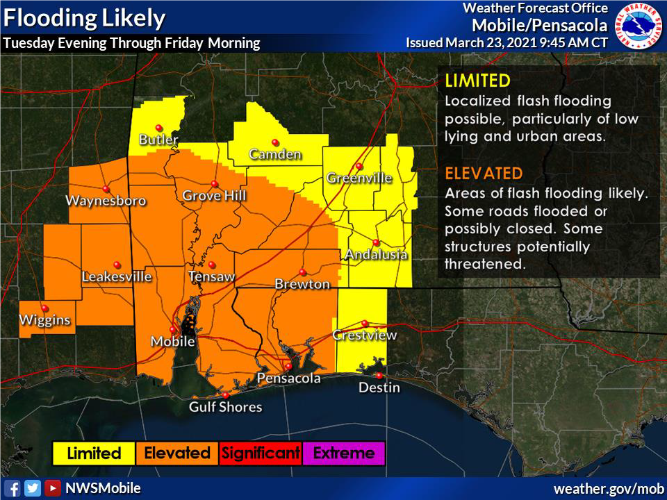
According to the National Weather Service of Mobile/Pensacola, heavy rain and thunderstorms from the west will begin to move toward the city of Greenville beginning this afternoon into the early evening.
This collection of storms have the potential to cause some flash flooding, particularly in local urban areas. The greatest potential for flash flooding will be this evening into Wednesday morning.
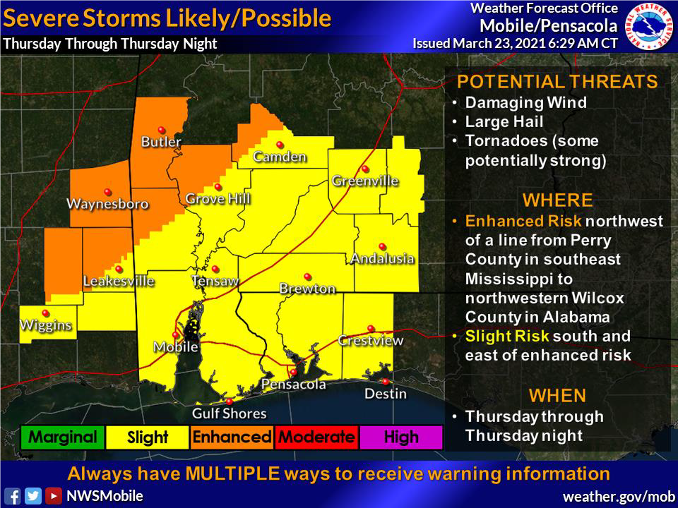
Thursday will transition to a potentially significant severe weather threat, however, it is likely to diminish by late evening.
Thursday’s storms could potentially produce strong tornados, damaging winds of 70 mph or more, and large hail. The greater influx of storms will develop in areas west of I-65.


